OkMap 14.12.6 (x64) Multilingual
OkMap 14.12.6 (x64) Multilingual | 144.26 Mb
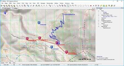
OkMap is an interactive software which allows you to work on your computer screen with web maps or digital maps that you have either bought or scanned. OkMap can also import vectorial data from the most common formats and DEM data relevant to height information. Through these maps, you can organize your paths by creating waypoints, routes and tracks on your computer monitor, and upload this data to your GPS. OkMap sets automatically altitude data and estimates travel times.
Features:
OkMap is an interactive software which allows you to work on your computer screen with web maps or digital maps that you have either bought or scanned. OkMap can also import vectorial data from the most common formats and DEM data relevant to height information.
Through these maps, you can organize your paths by creating waypoints, routes and tracks on your computer monitor, and upload this data to your GPS. OkMap sets automatically altitude data and estimates travel times. Furthermore OkMap provides you also with autorouting and geocoding functions.
Data collected by your GPS can be downloaded on your computer, stored and displayed on the maps. They can also be used to create different types of statistics.
By connecting a GPS to your laptop, you can Description your position on maps in real-time. If you are connected to the network you can constantly send your position to a remote computer, or receive the position of your companions on your computer and display the related tracks on maps in real time.
Whats New:
GPSBabel: New version 1.6.0.
C ++: New version 14.23.27820.0.
Enabled the management of vector data in web maps.
New function: Export vectorial data in OkMap format.
Preferences: Receiving remote data at startup (OkMap and GpsGate).
FIX: Importing vectorial dаta: The datum was not converted in the calculation of the metric coordinates.
FIX: File - Save - Map - KMZ: It always oriented the image to the north.
FIX: Tracks: The navigation bitmap overwrote the trace end bitmap.
FIX: Calculate distances: Incorrect management of the measurement window on the map change.
FIX: Menus were not enabled / disabled after drawing a pie / icon / comment.
Operating System: Windows 7 or higher (64-bit only)
Home Page -
https://www.okmap.org/https://www.okmap.org/Language: Multilingual
Buy Premium From My Links To Get Resumable Support,Max Speed & Support Me


Discovering free software download can be a game-changer for users looking to enhance their digital experience without breaking the bank. These platforms offer a vast array of software free download options, covering everything from productivity tools to entertainment applications. The beauty of these sites is not just the price (or lack thereof) but also the variety and accessibility they provide, ensuring that there's something for every type of user.
Comments (0)
Users of Guests are not allowed to comment this publication.